Henderson Wave


 (4 vote, 75.00% worth checking out)
 Location:
Southern Ridges walking trail
Singapore
Singapore
coordinates: 1.2772673,103.8156128
open coordinates in google maps
open coordinates in apple map
Building names(s): Henderson Wave
Architect/Designer: RSP Architects + IJP Corporation
architect website:
more images:
Completion date: 2008
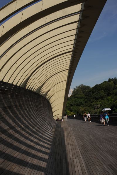
description: The 274m-long and 8m-wide Henderson Waves connects Mount Faber to Telok Blangah Hill. It is the highest pedestrian bridge in Singapore at 36m above Henderson Road. Its distinctive wave-like structure comes from seven undulating curved "ribs" that alternately go above and below the bridge deck. Where these "ribs" rise over the deck, they form alcoves that provide shelter to visitors. The deck itself is made of yellow balau wood, an all-weather timber found in Southeast Asia.
updated on: 26 October 2010 | suggested on: 26 October 2010 |
Suggested By LT
